Out and About: Tales told in the terrain
Published 5:00 am Sunday, December 29, 2024
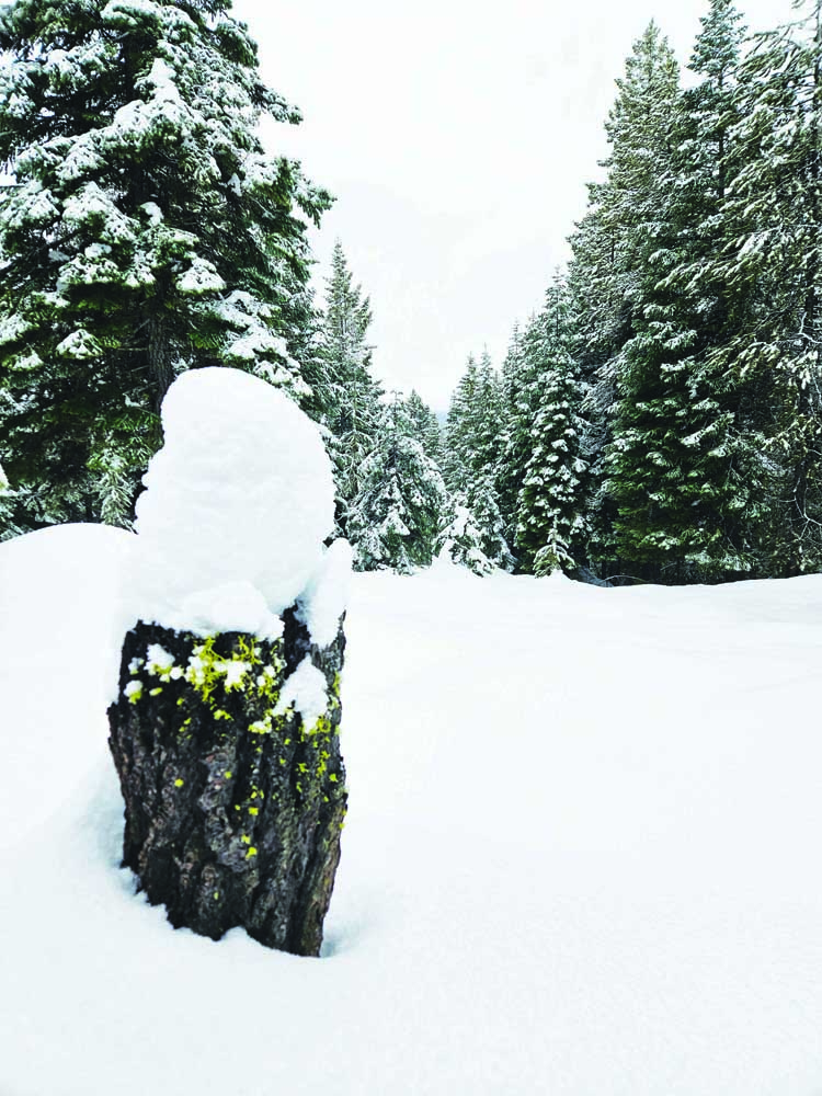
- Snow on a Douglas-fir stump near Blue Springs Summit on Dec. 22, 2024.
The rumpled terrain that characterizes Northeastern Oregon writes compelling tales for anyone willing to walk even a modest distance.
The lay of the land can have drastic effects in the span of a dozen strides.
The view, of course, changes when you reach the apex of a ridge that had until that moment hidden the horizon.
But topography alters more than vistas.
I was reminded of this during a couple of snowshoeing excursions the week before Christmas.
In both cases the demarcation was between a slope facing south and one facing north.
This, it seems to me, is the ultimate boundary in our region, which lies about midway between the equator and the North Pole.
Due to our place on the globe, the difference in the amount of sunlight that reaches south slopes compared to north slopes is dramatic.
And that discrepancy reveals itself in multiple ways.
The most obvious, of course, involves sunshine and shade.
The difference is heightened during winter given the sun’s comparatively low position in the sky. Around the solstice, a north slope might be in shade for all but a brief period late in the afternoon as rays from the westering sun penetrate the protected ground.
The adjacent south slope, meanwhile, might absorb sunlight for most of the period between dawn and dusk.
On the afternoon of Dec. 19 I drove a mile or so up the Union Creek Road from Highway 7, on the north side of Phillips Reservoir about 17 miles southwest of Baker City. I set off on snowshoes through the ponderosa pine forest east of Union Creek.
The temperature, as it has been more often than not this winter, was above freezing, although only by several degrees.
The snow had the grainy texture typical of spring, more like granulated sugar than the powdered variety.
I was surprised, though, by the depth.
I expected that the previous two weeks of generally mild weather would have diminished most of the snow that accumulated during storms in November and early December.
But in sheltered places, where wind-driven snow is apt to settle, the snow was more than a foot deep.
I walked east for half a mile or so, meandering between down logs, then began a traverse toward the crest of a ridge. I have been there before and was anticipating, on this mostly sunny day, a fine view extending to Mount Ireland and the Greenhorns to the west.
I was not disappointed.
But as I rested among the volcanic rimrock that crowns the crest I was looking down as much as up.
In the span of a few steps, as the north slope I had been ascending gave way to the plateau, the snow went from slightly slushy to a consistency more akin to oatmeal, only with less dietary fiber.
And there was quite a lot less of it.
Just north of the ridge the snow had drifted in places, such as the lee side of a pine, to about knee-high (on my knees, anyway).
But on the south slope below the ridge there was only a few inches of snow, and in the slightly sheltered ground beneath many trees the ground was bare.
On the north side of the crest it felt like winter — albeit winter during a thaw.
But on the top, and to the south, it seemed like spring, the air soft on the skin, the damp ponderosa pine needles squishy underfoot, like al dente spaghetti.
Three days later, my wife, Lisa, and I drove to Blue Springs Summit, the pass on the highway between Sumpter and Granite.
The 5,864-foot summit lies on the boundary between Baker and Grant counties.
It’s a convenient spot because there’s a large parking area — popular particularly with snowmobile riders — that is reliably plowed.
We strapped on snowshoes and walked north from the pass. I took a sinuous course, following the ephemeral highways of the snowshoe hares, and so we probably crossed between the two counties multiple times, as the border follows the ridgeline.
The snow here was much deeper — around 3 feet — and an inch or so of new snow had fallen overnight from a storm that brought only dismal pre-Christmas rain to Baker City.
But the fresh white carpet, though only several hours old, was already well-trodden by the hares.
I don’t know the typical population density of snowshoe hares so I can’t say whether a goodly number had gamboled through the woods or whether it was just a handful of especially energetic bunnies.
The effects of terrain, of slope, were less blatant here than at Union Creek.
Mostly because of the deeper snow, and because the temperature was right around freezing.
There was no appreciable difference in the depth, or the consistency of the snow, as we traveled on south, east, north and west slopes.
But this is not so when it comes to the forest.
In the Blue Mountains, the woods on the north and east sides of a ridge often are so different from those on the south and west sides as to seem to belong to altogether separate provinces.
Near Blue Springs Summit, the forest on north- and east-facing slopes, where sunlight is comparatively scanty but moisture plentiful (in part because snow lingers longer in spring), is both more dense and more diverse. This is a classic mixed-conifer forest, with two kinds of pines (ponderosa and lodgepole) represented, two sorts of firs (grand and Douglas-), as well as tamaracks.
On the return to the parking lot, though, we traveled mainly on west and south slopes.
As is typical in the Blues, these sunnier exposures are more suitable habitat for ponderosas, which are much less tolerant of shade than firs.
In centuries past, lightning fires perpetuated this pine-dominated forest by burning the fledgling firs before they could compete — and eventually crowd out — the ponderosas, which have much thicker bark and can survive fires that mainly creep along the ground.
The Forest Service has been aiding this natural process in the Blue Springs Summit area by cutting and piling trees.
The snowshoe hares, at least based on their prolific tracks, don’t seem to prefer one type of slope, or forest, over another.
We never saw one, probably because we lacked the patience (or I did, at least) to pause for a few moments and stop making racket clomping through the snow on our plastic appendages. The hares, which swap their brown summer fur for the ideal camouflage of white, do not endure in a world of coyotes and hawks by blundering along blithely. They maximize the value of their camouflage by staying motionless when they detect a possible predator.
Still and all it was enjoyable to trudge along, taking advantage of the easier travel that deep snow affords, covering the logs, stumps and other obstacles that can prove annoying during the warmer seasons.
Besides the hare highways we saw several piles of discarded cone fragments at the bases of several trees, the detritus of squirrel meals.
I had hoped to see a coyote slinking through the snow, stalking its lunch in the great silence of the winter forest.
Lisa found a line of tracks.
I imagine, though, that many pairs of eyes watched us as we went, fleeing in the opposite direction or perhaps freezing until the sound of our steps had faded.
If You Go
Blue Springs Summit is on the paved county road between Sumpter and Granite. There is a large parking area as well as a vault toilet. Unlike many Oregon state sno-parks, Blue Springs Summit does not require an Oregon Sno-Park Permit.


